Walk Coordinator – Ruth Lane Other AARP Volunteers – Chris B, Ray & Nancy, Inna
Partners – St Johns Main Street, St Johns Farmers’ Market
Route Description:
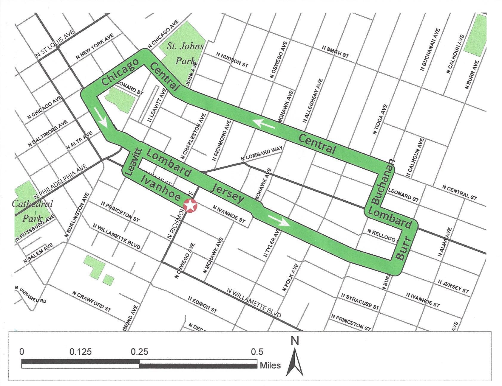
1. MEET at corner of N Richmond and N Ivanhoe (at benches) across from McMenamins St Johns Pub and Theatre – domed building was from 1905 Lewis & Clark Exposition. Freight movement on Route 30 Bypass – newly redone intersection, PBOT and ODOT working together. St Johns is revitalizing its business district plus new construction investment.
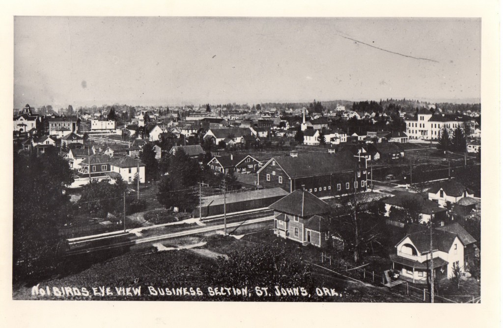 Our meeting point can almost be seen in this circa 1907 photo. We are just out of view on the right.
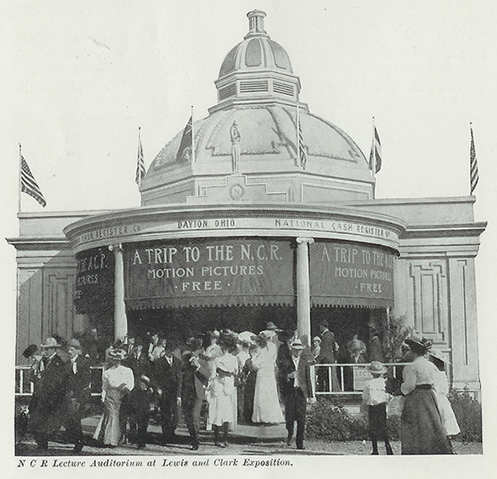 Here is how the National Cash Register Building looked in 1905 when it was part of the Lewis and Clark Exposition. More information about the fair can be found here.
2. START left (west) along Ivanhoe half-block; CROSS N Ivanhoe at N Charleston.
3. LEFT (west) along N Ivanhoe two blocks to N Leavitt. Note Farmers’ Market in the Plaza to our left; we’ll end there.
Today called the Town Plaza the intersection of Philadelphia, Burlington, and Lombard was previously known as Liberty Square. ( Our History Quiz can be found here. )
4. RIGHT (north) along east side of N Leavitt one block to N Lombard. Note The Man’s Shop, from 1940, and Pattie’s Home Plate Café, soda fountain with Pattie’s Cruise-In in August.
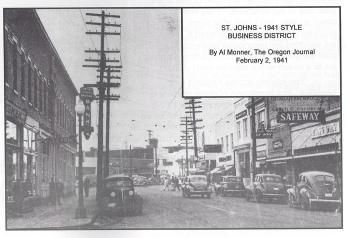 The current location for the Man's Shop had been a Safeway store.
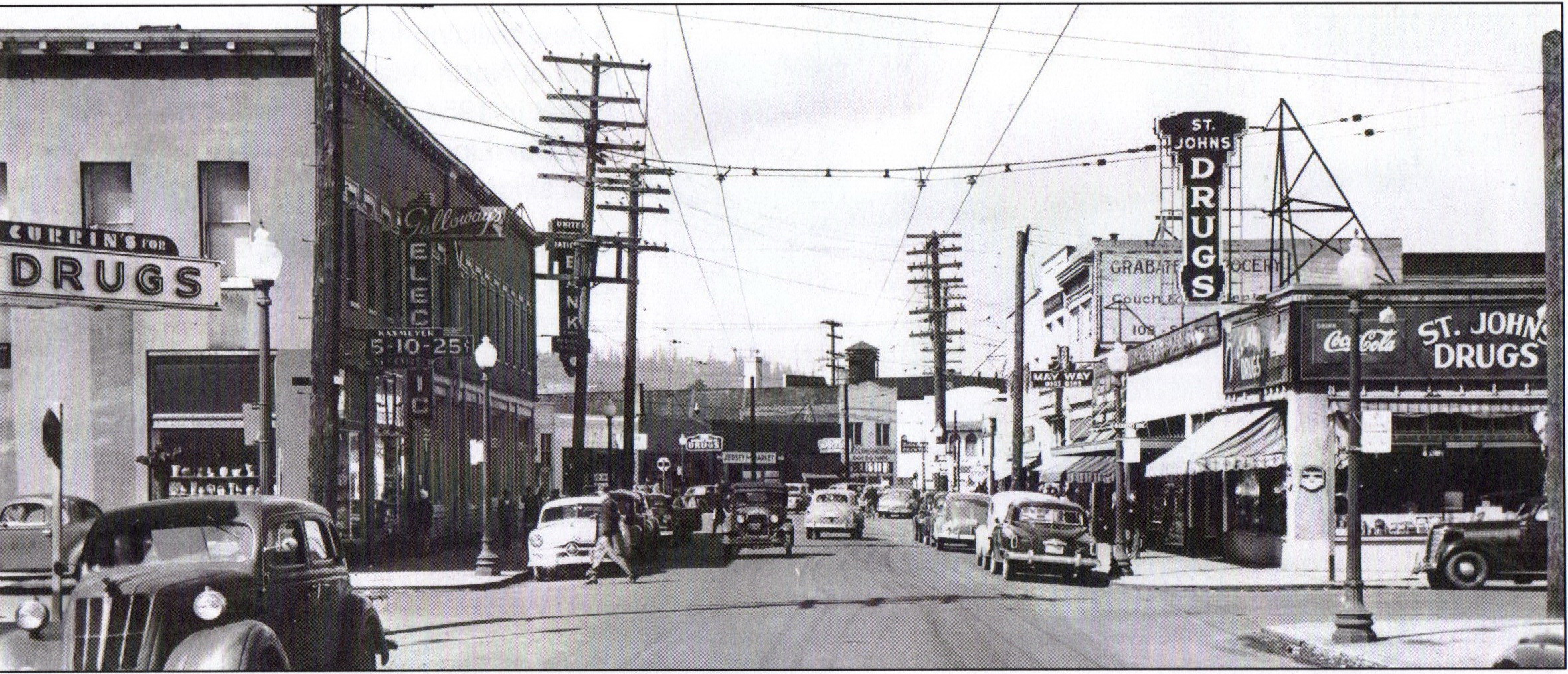
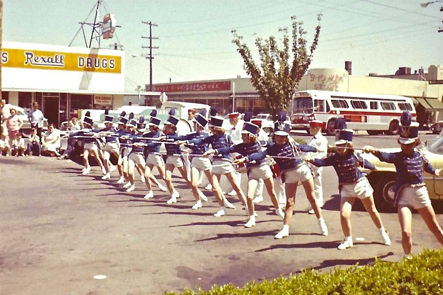 Pattie’s Home Plate Café had previously been home to St. Johns Drugs and The St. Johns Rexall Drug.
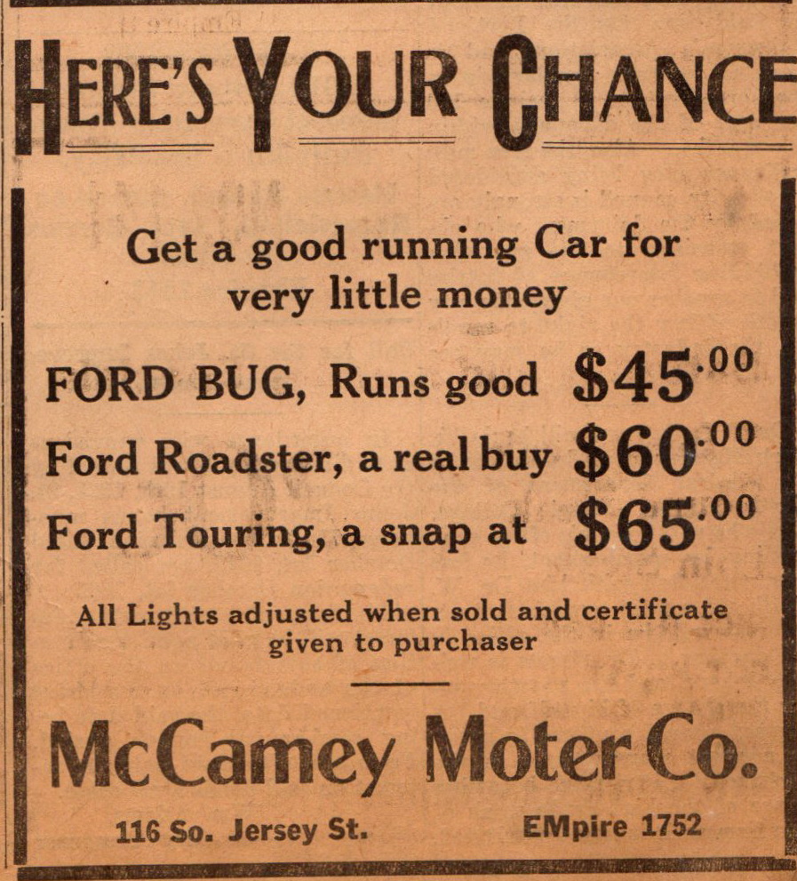 Going back further - September 1925. Future location of Patties Home Plate Cafe.
5. RIGHT (east) on N Lombard – Salty Teacup, Sabi & Friends, and Tulip Pastry, from 1950.
6. STOP at west side of N Charleston (Signal Station Pizza) – Meet Lindsay Jensen, Executive Director of St Johns Main Street.
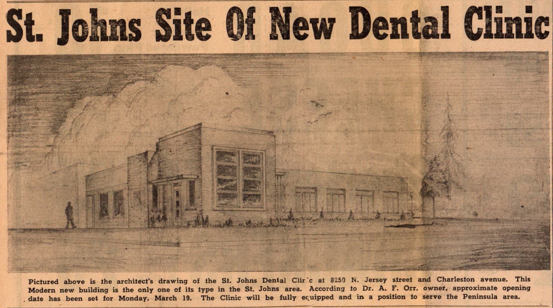 St Johns Dental Clinic 8250 N Jersey (Lombard) March 1951. Later home to St. Johns Main Street.
a. Cater-corner (NE) is latest construction project, “The Union at St Johns” (100 units)
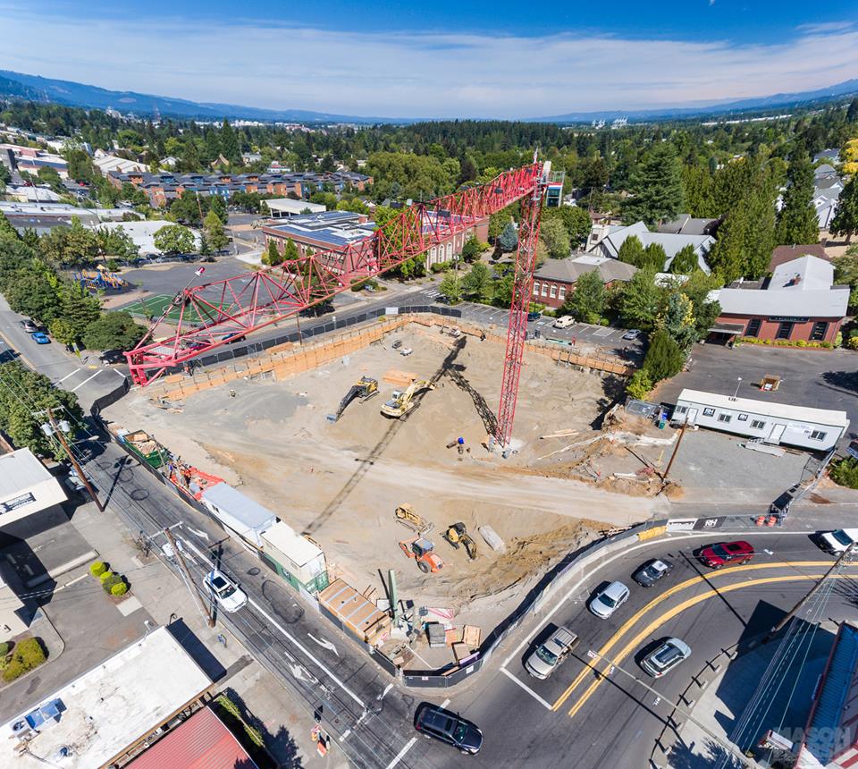 What had been here before? See below.
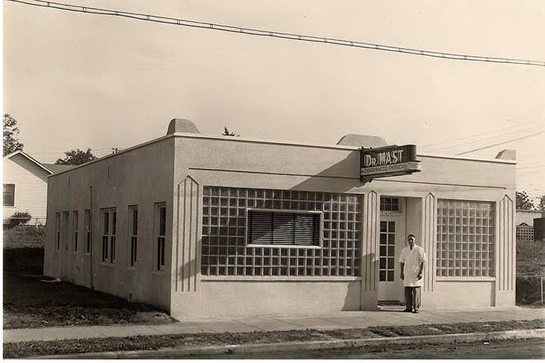 Located next to the library on Charleston - Dr. Carlton Mast's office circa 1940. This building later acquired a second floor and was remodeled into a church.
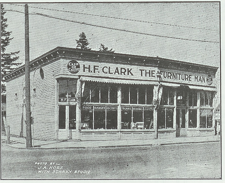 H.F. Clark was "The Furniture Man". This photo was taken prior to the completion of the St. Johns Bridge in 1931. By that time H. F. Clark's furniture business had been in St. Johns for 25 years. The address was 402 South Jersey Street. The City of Portland later changed the name of this street to North Lombard. Although not visible from this angle it is the point where Jersey and Lombard merge into one.
At the time the building was torn down it was over 100 years old. Learn more about H.F. Clark here.
b. Plan changes the “slip lane” at Gateway to St Johns (one block east at corner of N Richmond and N Lombard) to a “T”; developer, PBOT & ODOT working together
c. North on N Charleston are Multnomah County Library (LEED-certified Green Building) and James John Elementary School (total 3 elementaries, one middle, Roosevelt HS).
Learn about the history of St. Johns schools here & here.
7. Continue east on N Lombard one block to N Richmond; CROSS N Richmond, continue east on N Jersey for 6 blocks through residential area.
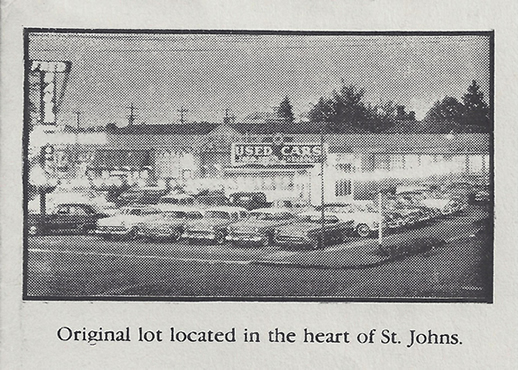 At the intersection where Lombard, Jersey, and Richmond streets merge was located Fred Bauer Chevrolet for many years. Fred Bauer took over the dealership from Raymond Fisher. Photo circa 1958. This history of Chevrolet dealerships in St. Johns can be found here.
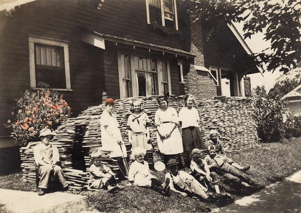 Corner of Jersey and Tyler 1920. Stack of wood on lawn is spare slabs of wood from the lumber mill used as firewood. Many home owners used this type of wood in their fireplaces prior to WWII.
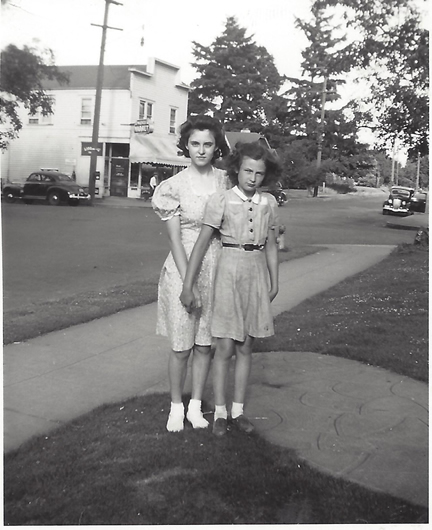 Corner of Jersey and Polk 1941.
8. LEFT (north) on N Burr one block; LEFT (west) on N Lombard. STOP at Kruger’s Farm Market and food cart pod with St Johns Beer Porch, firepit and many food choices.
9. Continue west on N Lombard half block to N Buchanan.
10. RIGHT on N Buchanan two blocks to N Central.
11. LEFT (west) on N Central for 10 blocks to N Chicago through residential area. Pass St Johns Community Center and St Johns Park on right, across from Matthew Frank Condominiums, first LEED-certified Green Building in St Johns, replaced the old Safeway in ~2000.
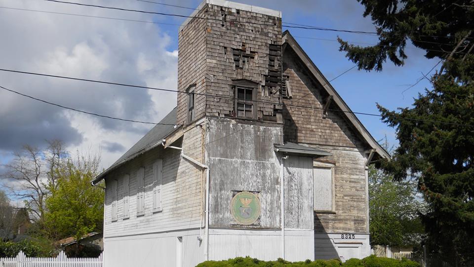
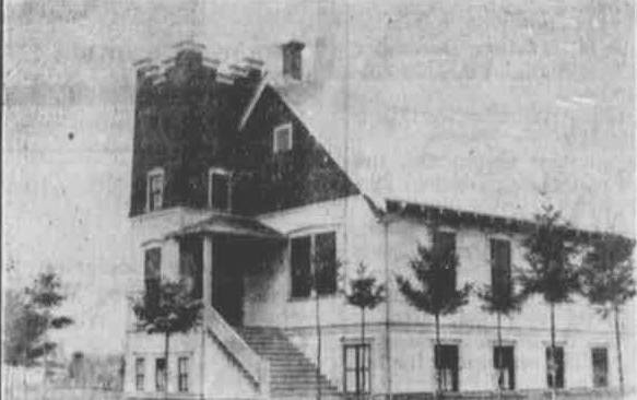 Mystery building from the St Johns review of December 4, 1914. This is what the Wilderness building at 8325 N Central looked like when it dedicated in Dec of 1914 as a Seventh Day Adventist Church.
12. LEFT (SW) on N Chicago 3 blocks to N Lombard.
13. LEFT (SE) on N Lombard 3 blocks to N Burlington; pass old Jower’s & BOA buildings, new “2/3 Development” mixed use. Pass Proper Eats vegan café & grocery, Santa Cruz tacqueria & grocery.
14. END at Plaza (on right) at N Philadelphia, Farmers Market, near base of the St Johns Bridge.
For those who want to continue to Cathedral Park, continue on N Philadelphia, down the right side of the bridge ramp 3 more blocks to entrance.
St Johns Farmers’ Market – closes N Philadelphia on Saturdays 9-2 May-October
St Johns Parade & Bizarre – 2nd Sat. in May, closes N Lombard – N Burr to N New York
NoFest – music in the streets, closes N Philadelphia one Saturday in summer
Cathedral Park Jazz Festival – third weekend in July
Pattie’s Cruise-In – old cars, one Saturday every August, closes N Lombard 3 blocks
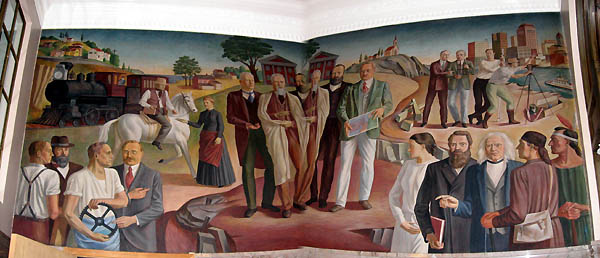
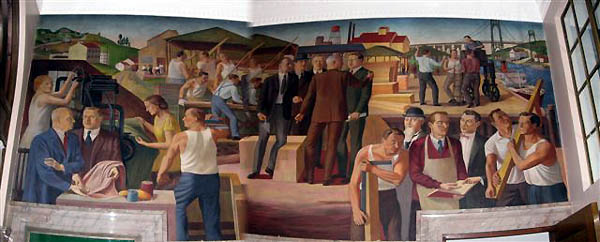
South on Baltimore is the old PO, now Baha’i temple, with WPA murals inside.Four blocks down are Cathedral Park Boat Ramp with parking, Cathedral Park Place (formerly Columbia Knitting Mills, now divided into small commercial spaces), Occidental Brewing and Moonstruck Chocolate
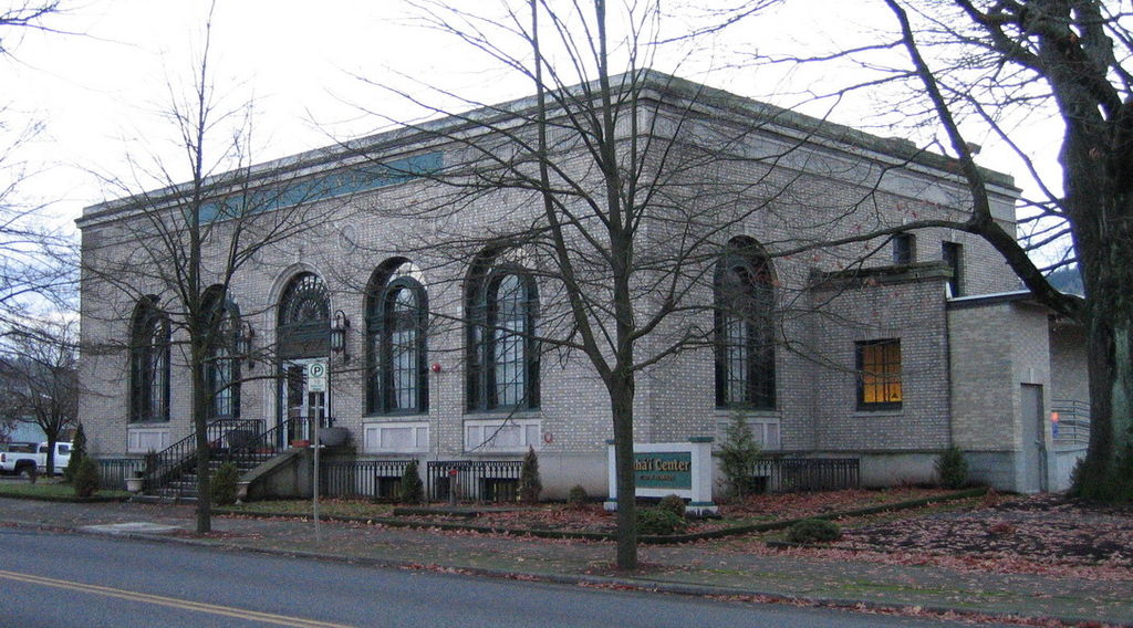 Former St. Johns Post Office - Wikipedia Link
